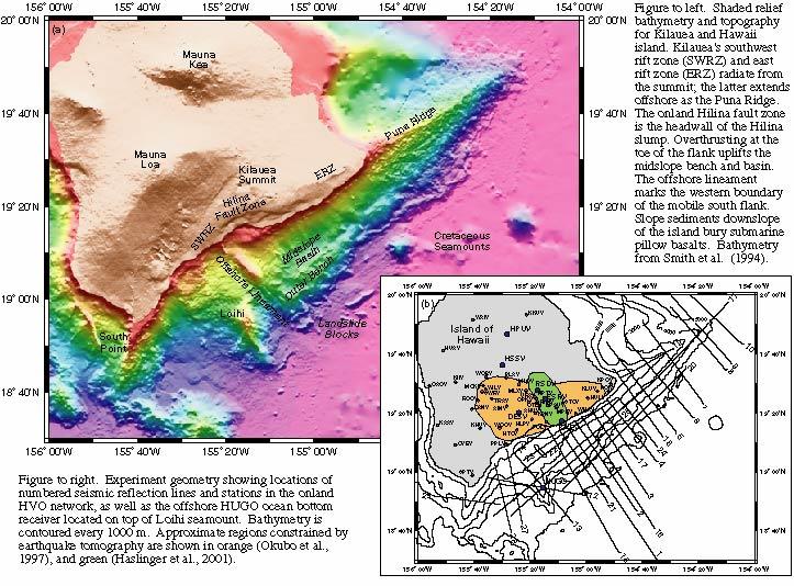
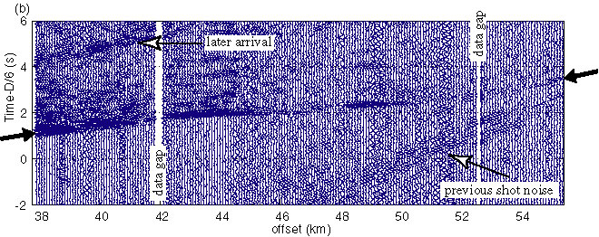
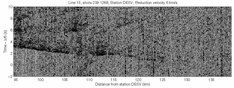
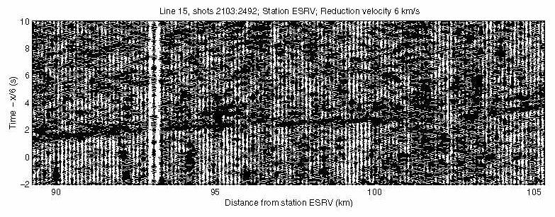
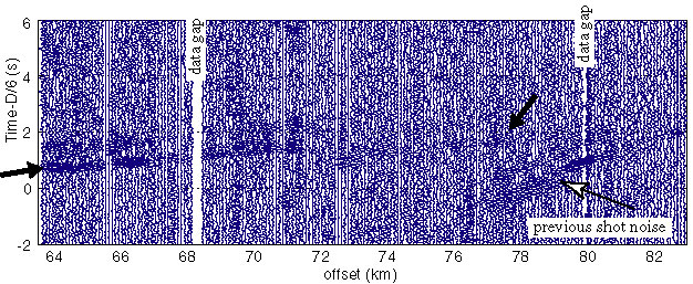
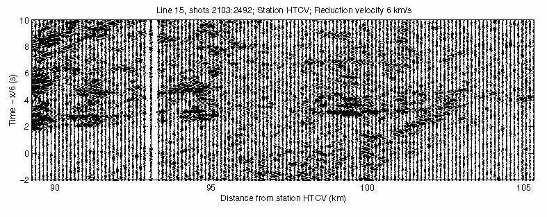
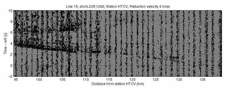
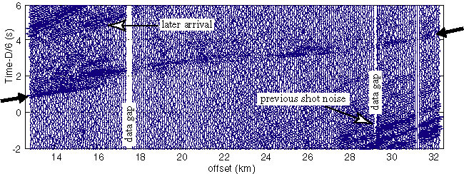
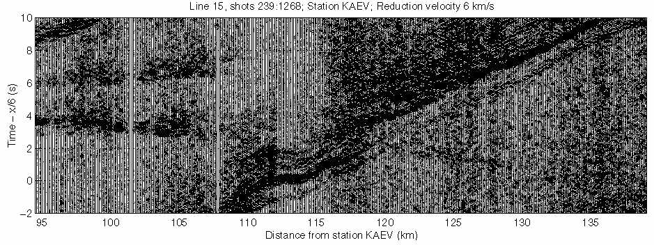
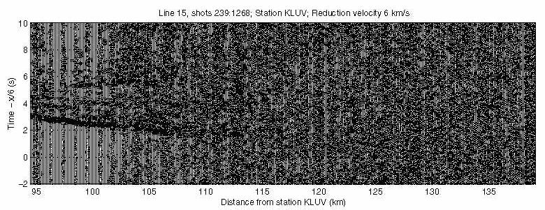
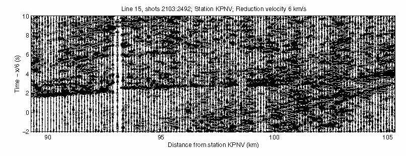
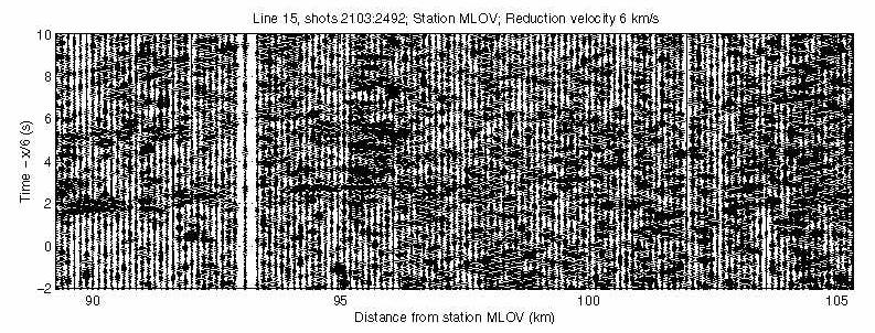
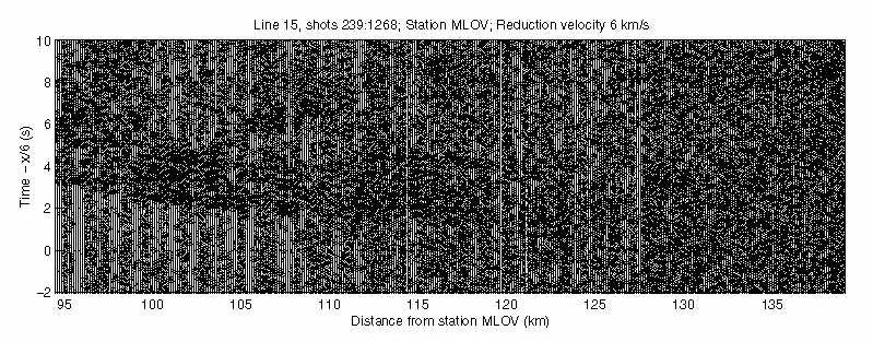
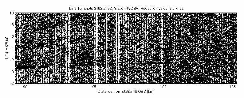
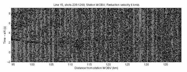
Airgun shots set off during the 1998 marine reflection survey carried out of the south flank of Kilauea volcano and adjacent flanks of the island of Hawaii on board the R/V Maurice Ewing, were also recorded by the permanent array of on-land seismic stations maintained by Hawaii Volcano Observatory - US Geological Survey. This data set provides the unique opportunity to study regions of Kilauea Volcano that have been poorly imaged by previous passive tomographic inversions. Our hope is to carry out a 3D tomographic inversion of these onshore-offshore data, and we have taken two steps toward that objective: (1) analysis of traveltime records for the marine shots, to identify first arrivals and important refraction/reflection interfaces, and (2) a forward modeling exercise of traveltimes using realistic 3D velocity models for Kilauea Volcano (see our ABSTRACT submitted to Fall AGU 2001).
A bathymetric-topographic map of the study area, including locations of the marine seismic lines and HVO seismic stations is shown below.
| Line 1 | Line 15
|
|---|---|
| Station DES | Station DES
|
| Station ESR
|
|
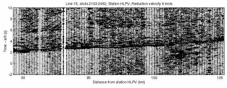
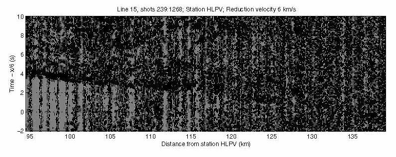
| Station HLP
| Station HLP
|
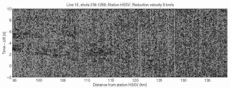
| Station HSS
| Station HSS
|
| Station HTC
| Station HTC
|
| Station KAE | Station KAE
|
| Station KLU
|
| Station KPN
| Station KPN
|
| Station MLO
| Station MLO
|
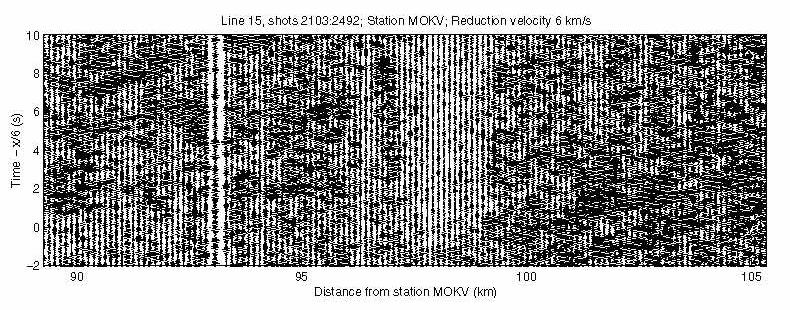
| Station MOK
|
|
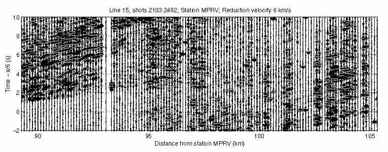
| Station MPR
|
|
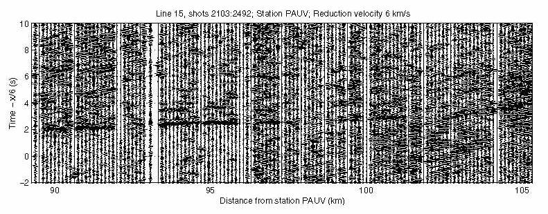
| Station PAU
|
|
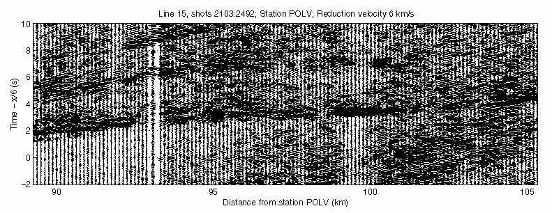
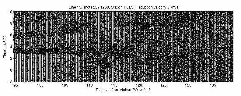
| Station POL
| Station POL
|
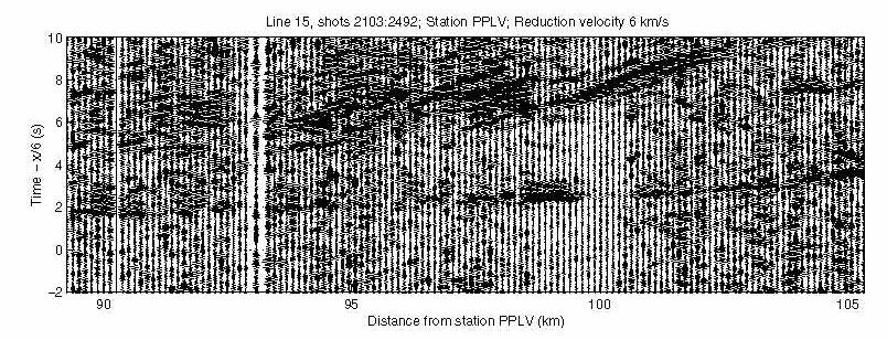
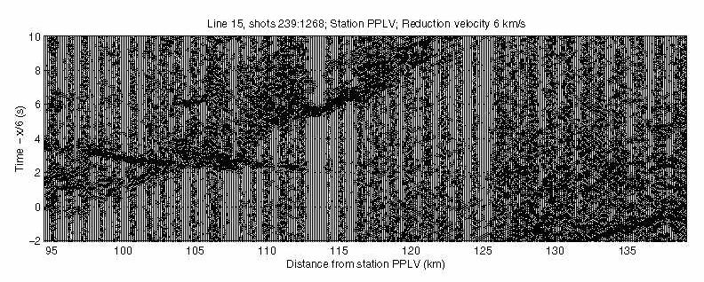
| Station PPL
| Station PPL
|
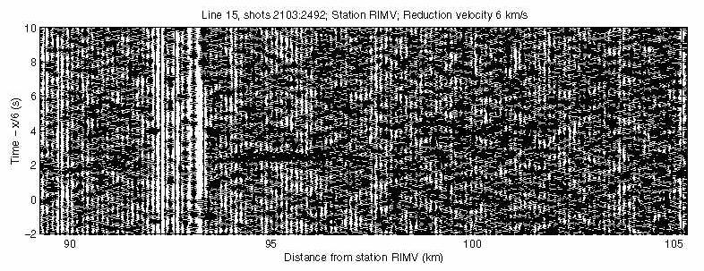
| Station RIM
|
|
| Station WOB
| Station WOB
|