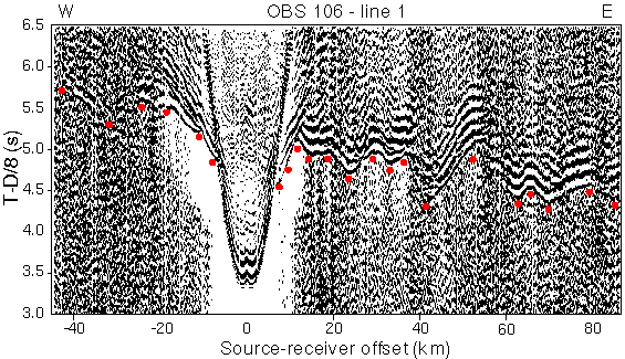
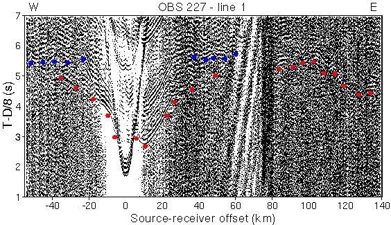
Fig. 3. Examples of OBS data recorded along line 1 in the west (OBS 106) and east (OBS 227). First arrivals from the sediments, crust and mantle are indicated by red dots; reflections from the Moho indicated by blue dots. Data are reduced using 8 km/s and trace normalized.
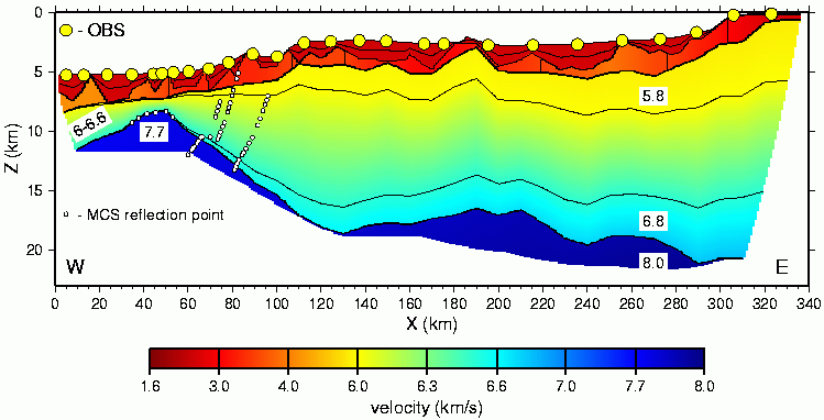
Fig. 4. Velocity model for line 1 obtained by inverting about 1900 traveltimes from 26 OBS/OBHs and the MCS data. Velocities in the crust and upper mantle are indicated on the west and east sides of the model. Reflection points from the MCS data that were inverted jointly with the wide-angle data are indicated; those between 30 and 55 km correspond to the S reflector/moho. Unconstrained regions of the model have been omitted (Fig. 5).
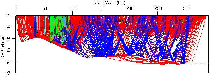
Fig. 5. Raypaths through the line 1 velocity model. Raypaths correspond to the data picked from the wide-angle and MCS data used in the traveltime inversion, thus illustrating the true ray coverage of the model. Red paths are refractions, blue paths are PmP wide-angle reflections, light blue paths are MCS reflections from the S reflector/moho, and green paths are reflections from the MCS data treated as floating reflectors. About 1900 arrivals from 26 OBS/OBHs and the MCS data were inverted.